แนะนำแหล่งท่องเที่ยวเมืองไทย Destination in Thailand.
เที่ยวไทยครึกครื้น..เศรษฐกิจไทยคึกคัก แนะนำแหล่งท่องเที่ยวใหม่ๆที่คุณอาจไม่เคยรู้
วันอังคารที่ 20 ธันวาคม พ.ศ. 2554
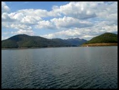
ปางอุ๋ง Pangung
การเดินทาง : รถยนต์ส่วนตัวเดินทางออกจากเมืองแม่ฮ่องสอนไปตามเส้นทางแม่ฮ่องสอน-ปางมะผ้า-ปาย ประมาณ 10 กิโลเมตร จะมีป้ายบอกว่าเลี้ยวซ้ายไป "บ้านรวมไทย" ขับไปตามทางเรื่อยๆ จะผ่านน้ำตก ผาเสื่อ พระตําหนักปางตอง ให้สังเกตทางแยกซ้ายมือจะมีป้ายเล็กๆ เขียนบอกว่าไป "บ้านรวมไทย" ให้เลี้ยวซ้ายตรงไปเรื่อยๆ จนถึงหมู่บ้าน ห้วยมะเขือส้ม ซึ่งจะมีทางแยกรูปตัว T เลี้ยวขวาตรงแยก ตรงไปอกี ระยะหนึ่งก็จะถึง "บ้านรวมไทย" หรือ "ปางอุ๋ง"
รถประจําทาง: นั่งรถ บขส. กรุงเทพฯ-แม่ฮ่องสอน จากนั้นไปต่อรถสองแถวประจําทางหน้าตลาดขึ้นไปยังปางอุ๋ง (บ้านรวมไทย) สายแม่ฮ่องสอน-ห้วยมะเขือส้ม เที่ยวไป 9.00 น. และ 14.00 น. เที่ยวกลับ 6.00 น. และ 11.00 น.
*******************************************************************************
"Pang Ung" for people who want to experience. Nature is truly fresh. The distance to be traveled to reach Pang Ung, we have to go through a winding road along the route. Steep and narrow in some years. If you are not qualified to drive up the mountain, it requires caution. It is not. I certify that I have arrived Pang Ung. Then everyone would be saying the same voice said. "It's worth a lot ..." Pang Ung. The full name means "the king's action, Pang Tong 2 (Pang Ung)" in the Royal Arashi snoopy HH Supreme Camp of Her Majesty the Queen is a beautiful place. Especially in the morning sun light up the water. Through the pine trees and a thin white mist. It is very impressive. In the afternoon or evening around 4 pm until sunset. It is a beautiful sunset as well. Blue sky. Green trees reflected in water in the lake. The royal white and black swans swim show. Picturesque elegance like in the novel. Here is a comment. For tourists to take photos of crabs. Keep in mind is that many points. In the village. As we can see life as a simple villager. Of the stores. Souvenir cards postcards. Count the variety of people open. Services it provides. The water in the lake basin area, not to mention whether you're standing in my corner, I guarantee that at every point. Available for rent a car, bike riding, sightseeing around $ 100 per trip, or to ride in a scenic river. Among the natural reservoir of the siege, they can impress you as well, priced at 150 baht for 2 persons per order is to use their own generators, from 18.00 hrs - 22.00 hrs to me after dark. Only light from the stars in the sky only. Visitors should carry the torch body for convenience. The me of the tourists are not allowed to come after 18:00 because the path is very dark and dangerous for those who do not specialize. More important during the months of October through January each year a large number of tourists come here. The cause traffic congestion at the project is not enough to rule out a call for tourists. Contact us for permission to stay overnight before either house or a tent or sleeping with the hotel's second point is the Royal Project. In front of the dam. The ticket for the Arts and Crafts Center, Mae Hong Son province. Royal Road Khunlumprapas queen's patronage for the Road, Muang, Mae Hong Son, Tel. 0 5361 1244 and the Forest Department. The pine trees along the lake. Contact the park for a card that cave fish. Before reaching the entrance to Pang Ung 1 mile call. 0 5369 2055 was another trip. One of the things that we experience life. Well here. But everything must be. Ready physically and mentally before every trip, do not forget to check availability. Of your request for travel. Fun, and we sat ใhameroglืm!Travel by private car trip out of town in Mae Hong Son Route Photos - Pang Ma Pha - Pai, about 10 kilometers to the signs that a turn to the "home of Thailand" to drive along it will cascade through the mat of the lower weight. Pang Tong. Note the left junction with the small label. A saying that goes "home, and Thailand", turn left and go straight to it. Through the village. Eggplant, orange creek. This is a T-junction, turn right at the junction go straight to the guitar for a while, it would be a "total ban Thai" or "Pang Ung '.Bus: Bus Transport in Bangkok - Mae Hong Son Then go to the front of the bus fixed up to Pang Ung (Thai house) in Mae Hong Son - eggplant, orange creek to 9.00 am and 14.00 pm to 6.00 am and 11.00 am to return
วันอาทิตย์ที่ 18 ธันวาคม พ.ศ. 2554
อุทยานแห่งชาติปางสีดา Pang Sida National Park
น้ำตกปางสีดา อยู่ห่างจากที่ทำการอุทยานฯประมาณ 700 เมตร
เป็นน้ำตกที่ไม่สูงมากนักเบื่องล่างเป็นแอ่งน้ำกว้างใหญ่ บรรยากาศร่มรื่นและจะมีน้ำตกมากในช่วงฤดูฝนน้ำตกผาตะเคียน อยู่ห่างจากที่ทำการอุทยานฯประมาณ 3 กิโลเมตร โดยการเดินเท้าตลอดเส้นทางขึ้นสู่น้ำตกร่มรื่นด้วยแมกไม้หนาทึบ เป็นน้ำตกชั้นสุดท้านอยู่ในสายเดียวกับน้ำตกปางสีดาตกลงมาจากหน้าผาประมาณ 10 เมตรในหน้าน้ำ สายน้ำจะมีความรุนแรงดังก้องละอองน้ำฟุ้งกระจายทั่วบริเวณ
Pang Sida National Park is a major attraction of the province of Sa Kaeo District is covered in the 3rd District. Watthana Nakhon district, Nadi District, Sa Kaeo and the Prachinburi.Pang Sida National Park's terrain is mostly mountains. Forest in the National Park. The forests are rich with rainforest rainforest, dry evergreen forest and grassland to maintain the integrity of the forest plant species. The source of water such as creek and the creek water Ginseng Prong Creek, the creek before it flows into rivers, etc. Plabplึg plan or the world. The large size and small animals. More than 300 species including birds and animals such as gaur, wild elephant, banteng are deer, bears, tigers, crocodiles, wild boar, and also as a source of fresh water. The remaining one in the country.In Pang Sida National Park. A trip to the park from the city to Highway No. 3462, to the north. Distance of 27 kilometers, or Health Service Bus - The green canal water within the park also has other tourist attractions.Pang Sida Waterfall is located about 700 meters from the park office.The waterfall is not very high and it's a vast basin. Atmosphere and a waterfall in the rainy season, waterfalls, cliffs Showcase. Away from the park about 3 miles by foot along the path to the waterfall, surrounded by thick trees. Warning: a waterfall in a single call to Pang Sida Waterfall falling from a cliff about 10 meters in the water. River water will have a resounding violence spread throughout the area.Pang Sida National Park. Located at Moo 7, Tambon Muang Kaew has announced the establishment of a national park on 24 February 2525, covering a total area of approximately 844 square kilometers or 527,500 rai.
เขาค้อ Khokor
ชื่อเขาค้อ มีที่มาจาก ป่าบริเวณนี้มีต้นค้อขึ้นอยู่มาก ซึ่งโดยปกติต้นค้อจะขึ้นในพื้นที่ที่มีภูมิอากาศหนาวเย็น ป่าไม้ในแถบนี้เป็นป่าเต็งรังหรือป่าไม้สลัดใบ ป่าสน และป่าดิบ ที่น่าสนใจก็คือ พันธุ์ไม้ตระกูลปาล์ม ลักษณะคล้ายต้นตาล แต่ออกผลเป็นทะลายคล้ายหมาก แม้ปัจจุบันป่าจะถูกถางไปมากก็ตาม แต่ก็ยังมีให้เห็นอยู่บ้าง
สถานที่ท่องเที่ยงบนเขาค้อ นอกจากจะมีความสวยงามตามธรรมชาติแล้ว ยังเป็นสถานที่สำคัญอย่างยิ่งทางประวัติศาสตร์ของประเทศ เนื่องจากเป็นพื้นที่ ที่ทางราชการ ใช้ในการต่อสู้กับผู้ก่อการร้ายคอมมิวนิสต์ในอดีต ก่อนที่ผกค. จะแพ้พ่าย และสูญหายไปจากประเทศไทย ซึ่งสถานที่สำคัญหลายแห่งบนเขาค้อ ยังปรากฎหลักฐานเหล่านี้อยู่จำนวนมาก
สถานที่น่าสนใจบนเขาค้อ
อนุสาวรีย์จีนฮ่อ เป็นอนุสาวรีย์ทหารอาสาจากหน่วยรบกองพลที่ 93 ซึ่งมาช่วยรบในพื้นที่เขาค้อ และเสียชีวิตในการสู้รบ ตั้งอยู่เลยกิโลเมตรที่ 23 ของทางหลวงหมายเลข 2196 ไปเล็กน้อย
ฐานอิทธิ (พิพิธภัณฑ์อาวุธ) อยู่เลยกิโลเมตรที่ 28 ทางหลวงหมายเลข 2196 (ไปเล็กน้อย แล้วแยกขวาเข้าทางหลวงหมายเลข 2323 ไปประมาณ 3 กิโลเมตร เป็นจุดหนึ่งที่เห็นทิวทัศน์สวยงามและเคยเป็นฐานสำคัญทางยุทธศาสตร์ในอดีต ปัจจุบันจัดเป็นพิพิธภัณฑ์อาวุธ จัดแสดงปืนใหญ่ ซากรถถัง และอาวุธที่ใช้สู้รบกันบนเขาค้อ มีห้องบรรยายสรุปแก่ผู้เข้าชมเป็นหมู่คณะด้วย เปิดให้เข้าชมทุกวัน ค่าเข้าชมคนละ 10 บาท
อนุสรณ์สถานผู้เสียสละเขาค้อ อยู่บนยอดเขาสูงสุดของเขาค้อ อยู่เลยฐานอิทธิ ไปอีก 1 กิโลเมตร สร้างขึ้นเพื่อเทิดทูนวีรกรรมของพลเรือน ทหาร ตำรวจ ทหาร ผู้พลีชีพในการสู้รบเพื่อปกป้องพื้นที่ในเขตรอยต่อ 3 จังหวัด คือ พิษณุโลก เพชรบูรณ์ และเลย ตั้งแต่ปี พ.ศ. 2511-2525 โดยสร้างด้วยหินอ่อนเป็นรูปสามเหลี่ยมสูง 24 เมตร หมายถึง การปฏิบัติการร่วมกันระหว่างพลเรือน ตำรวจ ทหารในปี พ.ศ. 2524 ผนังภายในบันทึกประวัติอนุสรณ์สถานและรายชื่อวีรชนผู้เสียสละไว้ด้วย การเดินทาง ใช้เส้นทางหลวงหมายเลข 2196 ไปจนถึงกิโลเมตรที่ 28 ไปเล็กน้อย มีทางแยกขวาไปเส้นทางหมายเลข 2323 ประมาณ 3 กิโลเมตร รวมระยะทางประมาณ 31 กิโลเมตร
พระบรมธาตุเจดีย์กาญจนาภิเษก ตั้งอยู่บนยอดเขาค้อ ติดกับสำนักสงฆ์วิชมัยปุญญาราม ยอดเจดีย์บรรจุพระบรมสารีริกธาตุที่อัญเชิญมาจากประเทศศรีลังกา เจดีย์แห่งนี้ชาวเพชรบูรณ์สร้างขึ้นเพื่อถวายเป็นพระราชกุศลแด่พระบาทสมเด็จพระเจ้าอยู่หัว เนื่องในวโรกาสทรงครองราชย์ครบ 50 ปี ในวันสำคัญทางศาสนา เช่น วันมาฆบูชาจะมีประชาชนเดินทางมาประกอบพิธีกรรมทางศาสนา ทำพิธีเวียนเทียนเป็นประจำ
หอสมุดนานาชาติเขาค้อ
ตั้งอยู่ที่เดียวกับเจดีย์พระบรมสารีริกธาตุ เป็นหอสมุดขนาดใหญ่ออกแบบเป็นรูปเพชรคว่ำ สร้างด้วยกระจกสะท้อนแสง ภายในเก็บรักษาหนังสือทั้งภาษาไทยและ ภาษาต่างประเทศ ในเดือนธันวาคมของทุกปีจะมีการจัดงาน “วันนัดพบเอกอัครราชทูต ณ เขาค้อ”โดยเชิญเอกอัครราชทูตจากประเทศต่างๆ มาร่วมชมการแสดงศิลปวัฒนธรรมของจังหวัด
เจดีย์พระบรมสารีริกธาตุเขาค้อ ตั้งอยู่บนยอดเขาติดกับหอสมุดนานาชาติเขาค้อ บ้านกองเนียม หมู่ที่ 4 ตำบลเขาค้อ ที่ยอดเจดีย์บรรจุพระบรมสารีริกธาตุที่อัญเชิญมาจากประเทศศรีลังกา เจดีย์แห่งนี้ชาวเพชรบูรณ์สร้างขึ้นเพื่อถวายเป็นพระราชกุศลพระบาทสมเด็จพระเจ้าอยู่หัว ในวโรกาสทรงครองราชย์ 50 ปี และเป็นที่สักการะบูชาของพุทธศาสนิกชน ในวันสำคัญทางศาสนาจะมีประชาชนและนักท่องเที่ยวร่วมกันประกอบพิธีทางศาสนา เช่น พิธีเวียนเทียน
พระตำหนักเขาค้อ ตั้งอยู่บนเขาย่า พระตำหนักนี้สร้างขึ้นเพื่อน้อมเกล้าฯ ถวายแด่องค์สมเด็จพระเจ้าอยู่หัว ในวโรกาสที่เสด็จพระราชดำเนินทอดพระเนตรงานโครงการในพระราชดำริและทรงตรวจเยี่ยมราษฎรอำเภอเขาค้อและอำเภอใกล้เคียง เป็นอาคารคอนกรีตครึ่งวงกลมมีทั้งหมด 15 ห้อง รูปทรงแปลกตาไปจากพระตำหนักอื่น สามารถขออนุญาตเจ้าหน้าที่เข้าชมบริเวณโดยรอบพระตำหนักได้ การเดินทาง ใช้เส้นทางหลวงหมายเลข 2196 พอถึงประมาณกิโลเมตรที่ 29 ให้ไปอีกประมาณ 4 กิโลเมตร มีทางแยกด้านซ้ายไปพระตำหนัก ทางขึ้นเขาค้อค่อนข้างสูงชัน รถยนต์ควรมีสภาพดี และกำลังเครื่องยนต์สูง

เส้นทางการเดินทาง จากเพชรบูรณ์ไปเขาค้อใช้ทางหลวงหมายเลข 21 (เพชรบูรณ์-หล่มสัก) ถึงสามแยกนางั่ว ระยะทางประมาณ 13 กิโลเมตร เลี้ยวซ้ายไปตามทางหลวงหมายเลข 2258 อีก 30 กิโลเมตร อีกเส้นทางหนึ่งคือ ไปตามทางหลวงหมายเลข 12 (พิษณุโลก-หล่มสัก) ถึงหลักกิโลเมตรที่ 100 (บ้านแคมป์สน) เลี้ยวซ้ายเข้าเขาค้อตามทางหลวงหมายเลข 2196 อีกประมาณ 33 กิโลเมตร พาหนะที่จะขึ้นเขาค้อ ไม่ควรใช้รถบัสขนาดใหญ่ เพราะมีทางโค้งมาก ถนนค่อนข้างแคบและลาดชัน ควรใช้รถปิคอัพหรือรถตู้สภาพดี
นักท่องเที่ยวที่เดินทางโดยรถประจำทางสามารถเช่ารถสองแถวได้ที่ปากทางขึ้นเขาค้อ บริเวณแคมป์สน กิโลเมตรที่ 100 ในราคาวันละประมาณ 600 บาท มีรถจอดคอยให้บริการตั้งต่เวลา 08.00-17.00 น. หรืออาจเช่ารถสองแถวที่บริเวณตลาดเทศบาล ในตัวเมืองเพชรบูรณ์ ราคาวันละประมาณ 800 บาท
ที่พักบนเขาค้อ ที่เขาค้อมีรีสอร์ตที่พักให้เลือก เป็นจำนวนมากส่วนใหญ่จะอยู่บริเวณตำบลทุ่งสมอและแคมป์สน ห่างจากสถานที่ท่องเที่ยวบนเขาค้อประมาณ 30 กิโลเมตร ที่พักที่อยู่ใกล้ที่สุดได้แก่ บ้านพักทหารม้า กิโลเมตรที่ 28 ทางหลวงสาย 2196 กองพลทหารม้าที่ 28 และเรือนพักผู้ติดตามอยู่ใกล้กับพระตำหนักเขาค้อและเขาย่า ส่วนรีสอร์ทต่างๆ ที่ตั้งเรียงรายอยู่ตามเส้นทางขึ้นเขาค้อ
China, Hong monument. Volunteer as a monument to soldiers from 93 Brigade, which is to help them fight the battle in his neck. And died in the fighting. Located at kilometer 23 of Highway 2196 on this point.Base richness (Museum of the weapon) is at 2196 Highway 28 kilometers (a little, then turn right onto Highway 2323, about three kilometers from one point to see beautiful scenery and is an important strategic base in the past. The museum is currently classified as a weapon. The remains of the artillery, tanks and weapons to fight on his neck. The briefing room for visitors as a group with Open to visitors every day. Admission to each 10 Baht
Memorial sacrifice his neck. The highest peak of his neck. Go 1 mile to the base richness is built to respect the civilian, military, police, military heroism of martyrs in the battle to protect the joints in the three provinces of Phitsanulok and Phetchabun since the year 2511-2525 was created. 24-meter high marble triangle refers to the military cooperation between the civilian police in the year 2524 within the walls of history monuments and heroic sacrifice, with a journey to the 2196 route km. 28 point and turn right onto Highway 2323 about 3 miles total distance of 31 kilometers.Phra Chedi Kanchana Karnchanapisek. Located on top of his neck. M with m visual display cases here. Pinnacle containing the relics brought from Sri Lanka. This pagoda was built to honor the Royal London Charitable His Majesty the King. On the occasion, he reigned for 50 years on Monday as the religious people of all religious ceremonies. A candle lit ceremony.International Library of his neck.The pagoda is located at the same relics. Library design is a large diamond shaped face. Created by the reflector. The preservation of books in both Thai and Foreign language In December of each year will be held. "Today I met the Ambassador at his neck" by inviting Ambassadors from various countries. Attending cultural performances of the province.Buddha relics his neck. Situated on a hilltop adjacent to the Library of International Rights Division Home Products Moo 4, Tambon Khao Chedi containing the relics at the top brought from Sri Lanka. Tower of London is a charity created to give a royal king. The occasion of his 50-year reign as the worship of the Buddhists. The religious people and tourists will have a religious ceremony, like the candle lit.Khao Kho Palace. Based on his grandmother. This palace was built to Ngameklgaฯ. Offering unto the Lord the King. Visited the project on the occasion of His Majesty and the people who visit the nearby Khao Kho district. The concrete building has 15 rooms, half circle shape, so strange to go from the palace. Visitors can ask staff to travel around the palace, take Highway No. 2196 was approximately 29 kilometers to go about 4 miles and turn left to the palace. Up to his neck is quite steep. Car should be in good condition. And high power.Travel routes. From London to his neck, take Highway 21 (Phetchaboon - Lomsak), the intersection of sill. Distance of 13 miles, turn left onto Highway 2258 is a 30 kilometer route. Along Highway No. 12 (Phitsanulok - Lom Sak) to Km 100 (Ban Camp Son), turn left into his neck, about 33 kilometers by highway vehicles in 2196 to raise his neck. Do not use large buses. I have a lot of curves. The road is quite narrow and steep. Use a pickup or van in good condition.Travel by bus, minibus can be rented at the entrance to his neck. The Pine Camp at Km 100 on the price of 600 baht per day, a car park serving the time 8:00 to 17:00 am or may rent a minibus at the municipal market. In the city of London. Rates at about 800 Baht
วันอังคารที่ 22 พฤศจิกายน พ.ศ. 2554
ยอดดอยม่อนแจ่ม แม่ริม Monjam mountain
จุดชมวิวของดอยม่อนแจ่มหลักๆ ก็จะสามารถมองไปได้สองด้าน ด้านหนึ่งก็จะเป็นทิวเขาสลับกันไปไกลสุดลูกหูลูกตา อีกด้านก็จะเป็นไร่ปลูกพืชต่างๆ ของโครงการหลวง ซึ่งจะปลูกอ่ะไรก็จะเป็นช่วงๆ ที่เหมาะแก่การปลูกตามฤดูกาล อย่างช่วงที่มาเที่ยวครั้งนี้ที่เห็นหลักๆ เป็นหน้าเป็นตาเลยก็คือ สตอเบอรี่ และองุ่น
มาเที่ยวที่นี่สิ่งที่น่าสนใจเลยก็คือการมาพักแรม ซึ่งจะมีกระท่อม ทำจากไม้จำพวกไผ่ มุงหลังคาด้วยหญ้าคา เป็นหลังๆอยู่โดยรอบๆบริเวณ ทำไว้ให้เช่าสำหรับนักท่องเที่ยว มีห้องน้ำในต้ว หรืออยากกางเต้นท์ก็มีสถานที่จัดเตรียมเอาไว้ให้ อาหารการกินก็มีไว้คอยให้บริการ หรือจะพกกันไปทำเองก็ได้บรรยากาศไปอีกแบบ
ถัดกันในบริเวณใกล้ๆ มีเนินเขาที่เหมาะแก่การไปชมวิวอีกที่หนึ่งก็คือ ม่อนล่อง แต่ช้าก่อน ไม่ใช่ว่าทุกคนก็ไปได้น่ะครับ เหมาะกับคนที่ขับรถขับเคลื่อนสี่ล้อมากกว่า หรือกระบะสองล้อก็พอใหว แต่รถเก๋งอย่าเลย มอไซต์ใจลุยก็ถึงครับ
การเดินทางไปท่องเที่ยวม่อนแจ่ม ในศูนย์พัฒนาโครงการหลวงหนองหอยเดินทางออกจากตัวเมืองเชียงใหม่ ใช้เส้นทางสายแม่ริม ไปตามถนนหลวงหมายเลข 107 ไปประมาณ 15 กิโลเมตร จะเจอสามแยกเลี้ยวซ้าย ไปตามทางหลวงหมายเลข 1096 (แม่ริม-สะมิง เส้นทางนี้เป็นเส้นทางหนึ่งของเชียงใหม่ที่มีสถานที่ท่องเที่ยวหลายที่ด้วยกัน) อีกประมาณ 30 กิโลเมตร ถามทางจากชาวบ้านแถวนี้ได้ครับ จะเป็นทางแยกทางด้านขวามือ แยกเข้าไปในหมู่บ้าน ผ่านหมู่บ้านไปไม่ไกลก็จะเจอครับ มีป้ายบอกตลอดทาง
ม่อนแจ่ม เป็นพื้นที่บนสันเขาในระดับความสูงประมาณ1,350เมตร จากระดับน้ำทะเล บริเวณหมู่บ้านม้งหนองหอย อำเภอแม่ริม จังหวัดเชียงใหม่ มีความเป็นส่วนตัวและความสะดวกสบาย สัมผัสกับธรรมชาติอ สายลมเย็น ๆ วิวขุนเขา สายหมอก
การเดินทาง ม่อนแจ่ม ห่างจากตัวเมืองเชียงใหม่เพียง 40 นาทีเท่านั้น โดยมาตามทางหลวง หมายเลข 107 สายเชียงใหม่-ฝาง ตรงไปถึงอำเภอแม่ริม บริเวณกิโลเมตรที่ 17 ให้เลี้ยวซ้ายเข้าทางหลวง หมายเลข 1096 สายแม่ริม-สะเมิง บริเวณกิโลเมตรที่ 15 ให้เลี้ยวขวาที่บ้านโป่งแยก ตรงไปอีก 6 กิโลเมตร ก็ถึงบน “ม่อนแจ่ม”
ทั้งนี้ นักท่องเที่ยวที่สนใจสามารถสอบถามรายละเอียด และจองที่พักได้ที่ โทรศัพท์ 081-8063993 และ 053810765 ต่อ 108
Things that most people do not know. We encourage you to visit the edge of a nature that I doubt it. Doi "Monjam". Nong Hoi Royal Project in Mae Rim district of Chiang Mai Ram. When I arrived here a short walk from the parking lot. It overlooks the surrounding area. From where we stood. Simon's all good. There is not much space and it was not. You can easily walk around the shops that serve coffee, drink or eat. The view is likely to continue to be happy not ever.
Point of view of the mountain life any good. I can look at two aspects. One side is a mountain to far out of sight Other farm crops, it would be different. The Royal Project. This is not going to be growing from time to time. Suitable for the planting season. The visit was at the core. It is remarkable Storm berries and grapes.
Come here to do what it is to stay overnight. This is the hut. Made of wood such as bamboo. With a thatched roof. The other is the surrounding area. Made for tourists to rent. In the bathroom. The tent is not a place to prepare them for Food they are serving. Or to carry them to their own environment to another.
Next in the vicinity. It is best to have a hill to view another try, but shortly before it was Simon, not everyone has it. Suitable for people who drive four-wheel drive vehicles over The two-wheel truck that was enough. But cars do not. St. Louis, it's on my site.Free trip to Diamond Jam. Nong Hoi Royal Project in getting out of the city. Route to Rome. Along Highway 107 about 15 miles to I-junction turn left. Along Highway No. 1096 (Mae Rim - Sa Maung. This path is the path of one of London's many attractions together) is about 30 kilometers from my home in this area. The intersection of the right hand side. Separated into the village. Through the village will have to throw it. There are signs along the way.
Simon is a good area on the ridge in an altitude of about 1,350 meters. Above sea level. Hmong Nong Hoi Village Mae Rim, Chiang Mai. Privacy and comfort. Natural exposure to the cold wind from the mountain mist.
TravelMonjam, just 40 minutes away from the city by Highway 107, Chiang Mai - Fang. Go to Mae Rim. At Km 17, turn left onto Highway 1096 Maerim - Samoeng. At Km 15, turn right at Ban Pong, it's a straight for 6 miles on the "Monjam".
The tourists who are interested can contact. The Home at tel 081-8063993 and 108 053810765.
วันศุกร์ที่ 18 พฤศจิกายน พ.ศ. 2554
เขื่อนแม่กวงอุดมธารา Mae Kuang Udom Thara Dam
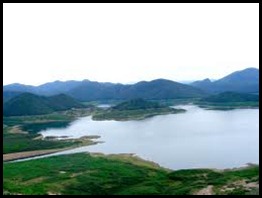 จุดเด่น ทัศนียภาพเหนือพื้นน้ำกว้างไกล ซึ่งสะท้อนให้เห็นภาพความสมบูรณ์ของเชียงใหม่ได้อย่างชัดเจน โดยโครงการสร้างเขื่อนแม่กวงอุดมธาราแห่งนี้เกิดขึ้นก็เนื่องจากพระราชดำริของ พระบาทสมเด็จพพระเจ้าอยู่หัว เมื่อ พ.ศ. 2508 และได้ก่อสร้างจนแล้วเสร็จเมื่อปี พ.ศ. 2535 สามารถรองรับน้ำได้ประมาณ 263 ล้านลูกบาศก์เมตร ด้วยความกว้างใหญ่ที่เปี่ยมล้นความสมบูรณ์ชุ่มชื้นชอุ่มนี้เอง จึงก่อให้เกิดพรรณไม่มากมายจนเขียวขจีไปหมด ยามได้มาพักผ่อนทำให้รู้สึกเพลินตาเพลินใจอย่างยิ่ง
ที่กิน มีร้านอาหารอยู่บริเวณริมเขื่อนให้เลือกหลายร้าน
ที่พัก พักได้ที่โรงแรมในตัวเมืองเชียงใหม่และรีสอร์ทใกล้เคียงซึ่งมีอยู่ประมาณ 2-3 แห่งอาทิ วังธารรีสอร์ท ริมเขื่อนรีสอร์ท
ที่ตั้ง หมู่บ้านวังธาร ต.ลวงเหนือ อ.ดอยสะเก็ต เชียงใหม่
การเดินทาง
ใช้เส้นทางสายเชียงใหม่-เชียงราย (ทางหลวงหมายเลข 118) ถึงอำเภอดอยสะเก็ต ระยะทางประมาณ 14 กิโลเมตร จากนั้นเลี้ยวซ้ายไปตามป้ายบอกเส้นทางเข้าเขื่อน ซึ่งมีขนาดใหญ่เห็นได้ขัดเจนแต่ไกลระยะทางอีกประมาณ 6 กิโลเมตร
***************************************************************************************
Highlights over the surface of the water over a wide distance. This reflects the integrity of the City as well. The Mae Kuang Udom Thara The dam of this happened because of the initiative. His Majesty the King on November 2508 and construction completed in 2535, can accommodate about 263 million cubic meters of water. Completely filled with a vast lush moisturizing it. Thus causing plants to be too much green. It makes sense to enjoy a vacation while his very eyes.
Eating at a restaurant near the dam to several stores.
Hotel accommodation at the hotel in the city and nearby resort which is about 2-3 such as Wang Tarn Resort. River Dam Resort.
The trick over the village, Wang, T. Tan, A. Doi skete.
Travel
Route to Chiang Mai - Chiang Rai (Highway 118) to Doi Sakete. Distance of 14 kilometers, then turn left and follow signs to the dam. This is big, you can see the big signs distance of about 6 km.
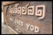
วัดเจ็ดยอด Wat jedyod
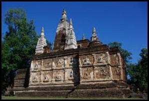 จุดเด่น เป็นวัดเก่าแก่เงียบสงบ ซึ่งมีความโดดเด่นอยู่ที่องค์เจดีย์รูปทรงแปลกตา คือมีเจ็ดยอด สร้างขึ้นราวพุทธศตวรรษที่ 19-20 เลียนแบบเจดีย์มหาโพธิ์วิหารพุทธคยาประเทศอินเดีย โดยรอบองค์เจดีย์มีรูปปูนปั้นเทพนั่งขัดสมาธิเพชร ซึ่งยังคงไว้ซึ่งลวดลายอันวิจิตรบรรจงสวยงาม นอกจากนั้นบริเวณไม่ไกลจากเจดีย์เจ็ดยอดเป็นที่ตั้งของเจดีย์ทรงปราสาท สร้างขึ้นเมื่อปี พ.ศ. 2030 เพื่อบรรจุพระอัฐิของพระเจ้าติโลกราช ผู้สร้างวัดนี้
ความเป็นมา วัดเจ็ดยอด เรียกอีกชื่อหนึ่งว่าวัดโพธารามมหาวิหารพระเจ้าติโลกราชโปรดให้สร้างพระอารามขึ้นเป็นแห่งแรกในปี พ.ศ. 1998 พร้อมกับปลูกต้นโพธิ์ไว้ด้วยจึงเป็นที่มาของชื่อวัดโพธาราม ซึ่งในปีพ.ศ. 2020 พระเจ้าติโลกราชได้ประชุมพระเถระเพื่อทำการสังคยนาพระไตรปิฏก ซึ่งเป็นครั้งที่ 8 ต่อจากการจัดที่ลังกา สิ่งอำนวยความสะดวก บริเวณวัดมีเพียงลานจอดรถ ไม่มีร้านจำหน่ายอาหาร หรือร้านค้าตั้งอยู่
การเดินทาง
วัดอยู่บนถนนซุปเปอร์ไฮเวย์ สายเชียงใหม่-ลำปาง ใกล้กับพิพิธภัณฑสถานแห่งชาติเชียงใหม่ ห่างจากตัวเมืองประมาณ 5 กิโลเมตร
*****************************************************************************************
Prominent old quiet. This is particularly striking is that strange shaped chedi is built around a seven-century Buddhist Pagoda, Maha Bodhi Temple 19-20 mimic Bodh Gaya, India. Around the chedi with my squat stucco diamonds. Which retains the pattern of exquisite beauty. The area not far from the seven-tower is the castle shaped chedi. Built in 2030 to contain the anti Tilokarach of God's kingdom. The creator of this measure.
The Wat Jedyod known as the Cathedral Photharam God's kingdom, please let us build the first monastery in the year 1998, along with the plant Po is the source of a measure Photharam. which in the year. Since 2020 the kingdom of God met us Thera to Sagc Garden Home Help Search Login. This is the 8th of arrangement Lanka. Facility Temple is a parking lot. There are no food stores. The shop is located.
Travel
The road superhighway. The Chiang Mai - Lampang Close to the Chiang Mai National Museum. About 5 kilometers away from downtown.
วัดเจดีย์เหลี่ยม Wat Chedi Liam
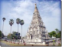 จุดเด่น เจดีย์เหลี่ยม ถอดแบบมาจากพระเจดีย์ที่วัดจามเทวีจังหวัดลำพูน เพื่อเป็นสิ่งสักการะแก่ประชาชน โดยซุ้มประตูทั้ง 4 ด้าน จะมีพระพุทธรูปประจำทิศอยู่ด้านละ 15 องค์ นับรวมแล้วมีทั้งหมด 60 องค์ เป็นศิลปะแบบขอม ซึ่งในภายหลังได้มีการบูรณะใหม่เป็นศิลปะแบบพม่า แต่ยังคงโครงสร้างเดิมอยู่
ความเป็นมา วัดเจดีย์เหลี่ยมหรือวัดเจดีย์กู่คำ สร้างขึ้นสมัยพญามังราย ประมาณ พ.ศ. 1831 หลังจากยกทัพมาตีเมืองลำพูนแล้วก็มอบเมืองให้อำมาตย์คนสนิทปกครอง จากนั้นพระองค์ก็ยกทัพไปสร้างเมืองใหม่ทางทิศตะวันออกเฉียงเหนือ อยู่ได้เพียง 5 ปีก็ยกทัพไปสร้างเมืองเชียงใหม่ อยู่ริมลำน้ำปิงโดยใช้ชื่อเมืองแห่งนี้ว่าเวียงกุมกามตรงกับปี พ.ศ. 2451 คหบดีชาวพม่าได้มาพบและเกิดตวามเลื่อมใสจึงทำการบูรณะจึงทำให้เจดีย์มีศิลปะแบบพม่าเข้ามาปะปน
การเดินทาง
วัดเจดีย์เหลี่ยมตั้งอยู่ที่ตำบลท่าวังตาล อำเภอสารภี ห่างจากตัวเมืองเชียงใหม่ประมาณ 4 กิโลเมตร ใช้ถนนสายเกาะกลาง-หนองหอย วัดอยู่ด้านขวามือ
*****************************************************************************************
Hilight main square. Replica of a stupa at Wat Chamadevi Lamphun. It is sacred to the public. In the fourth arch on the west side to the Buddha's body count of 15 and 60 who have a traditional Khmer art. Which later was restored to the Burmese art. The original structure still exist.
The Chedi Liam or Chedi Ku words. Created a set of Mangrai about 1831 after the army attacked the city of Lamphun, it offers a completely ruled Amat. Then he raised an army to build a new city in the northeast, it was only 5 years to build an army of Chiang Mai. Along the Ping River, the city of Wiang Kum Kam was the year 2451 with the wealthy people of Burma have been found, and the religious sector, the pagoda was restored with a mixture of Burmese art.
Travel
Temple Square is located at Tha Wang Tan District Sarapee about 4 kilometers away from city streets, the island - Nong Hoi. The right-hand side.


